My island
Summary of task
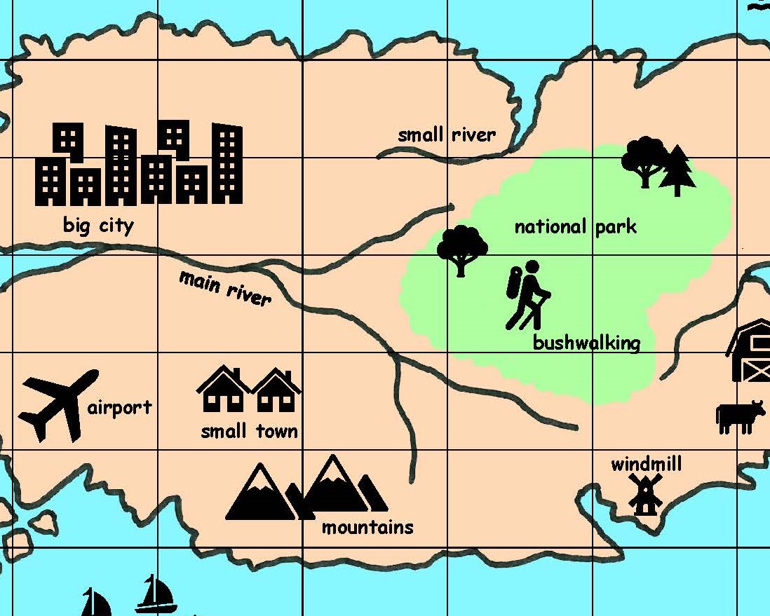
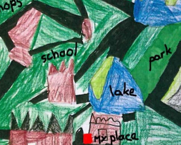
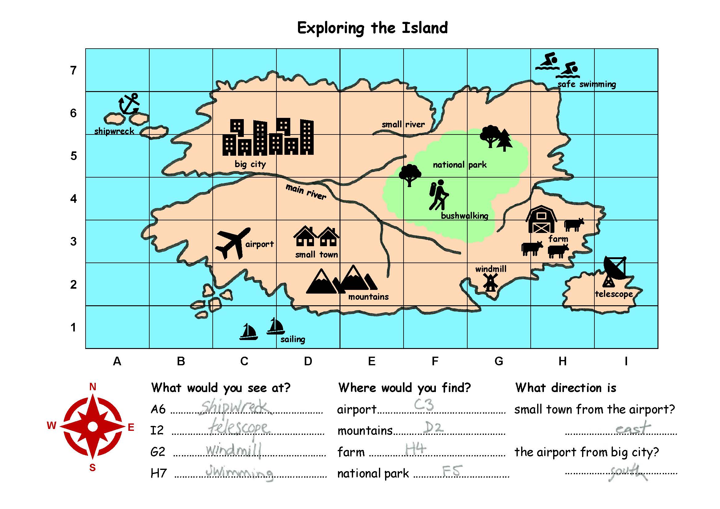
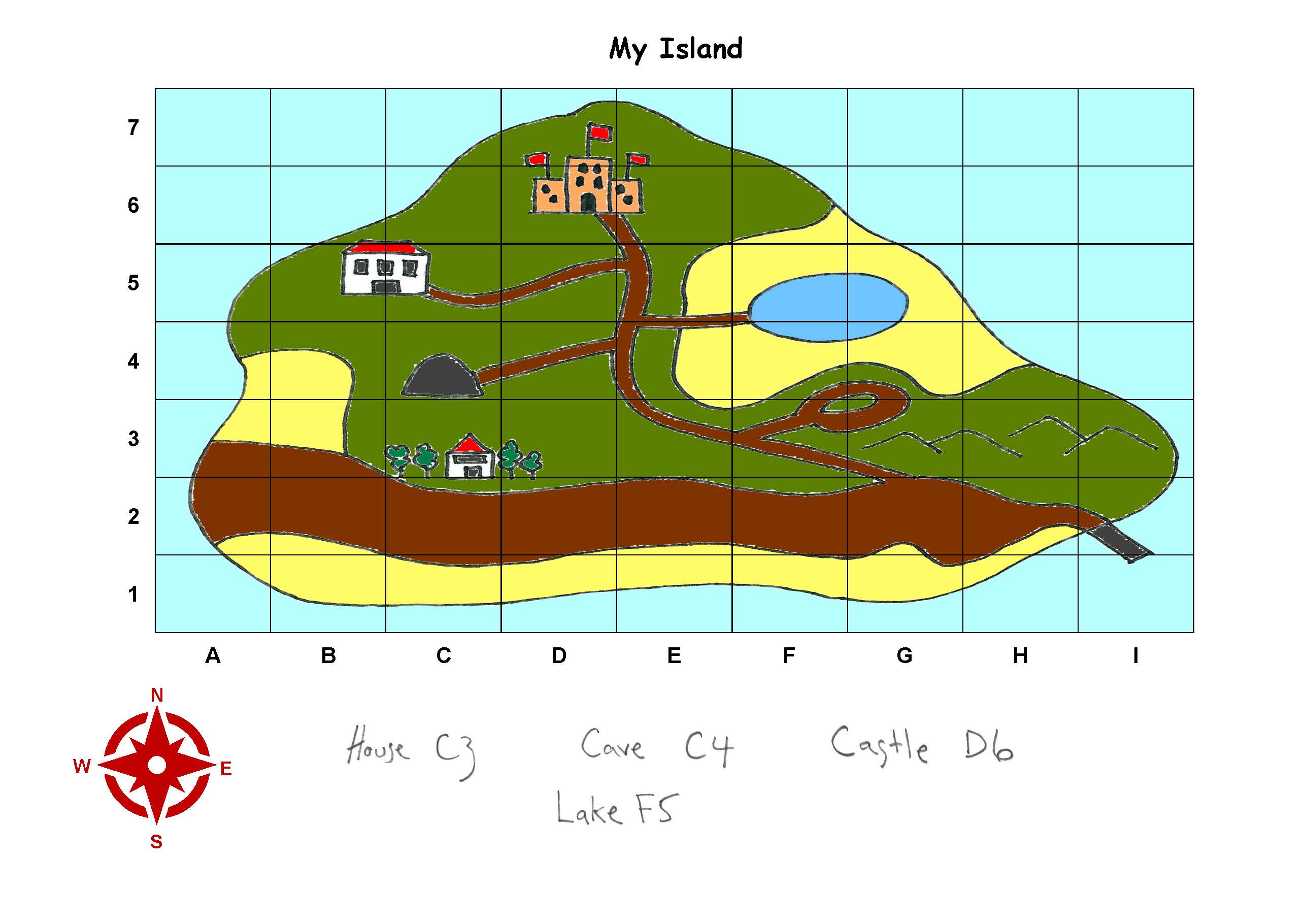
Students explored a range of maps through interactive activities, atlases and games. Students used grid references and compass directions to identify the location of features on a teacher-provided map. Students then created their own island maps and used grid references to identify the location of selected features. These activities took place in class over a period of three weeks.
Achievement standard
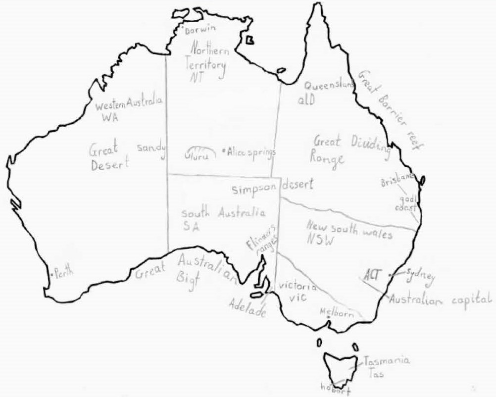
By the end of Year 3, students describe the location of the states and territories of Australia, the location of selected Aboriginal and Torres Strait Islander Countries/Places and selected countries neighbouring Australia. They describe the characteristics of different places at local scales and identify and describe similarities and differences between the characteristics of these places. They identify connections between people and the characteristics of places and recognise that people have different perceptions of places.
Students pose geographical questions and locate and collect information from different sources to answer these questions. They record and represent data in tables and simple graphs and the location of places and their characteristics on labelled maps that use the cartographic conventions of legend, title and north point. They describe the location of places and their features using simple grid references and cardinal compass points. Students interpret geographical data to identify and describe distributions and draw conclusions. They present findings using simple geographical terminology in a range of texts. They reflect on their learning to suggest individual action in response to a geographical challenge.
 1
2
3
4
1
2
3
4
-
Annotations
-
1
Subject - Geography
Uses grid references to identify the location of features on a map -
2
Learning Area
Uses grid references to identify the location of features on a map -
3
Learning Area
Uses compass points to identify direction -
4
Subject - Geography
Uses compass points to identify direction
 1
2
3
4
1
2
3
4
-
Annotations
-
1
Learning Area
Draws an island containing recognisable landforms and landmarks -
2
Subject - Geography
Draws an island containing recognisable landforms and landmarks -
3
Learning Area
Uses grid references to indicate the location of identifiable features -
4
Subject - Geography
Uses grid references to indicate the location of identifiable features